


 57 Huynh Thuc Khang - Dong Da - Hanoi

 02435533388
 vnptit@vnpt.vn


 Contact

UBND Quang Ninh City meets to direct the implementation of the task of building the land database (Photo: QTV).
Plan 2959: Key political task of 2026
Plan No. 2959/KH-BNNMT-BCA is implemented from 01/4/2026 to 31/12/2026 with the goal of strengthening and accelerating surveying, cadastral mapping, cadastral record compilation, and completing the national land database nationwide.
The focus of the Plan is to review, standardize, supplement, and refine the land database based on the criteria of "accurate - sufficient - clean - dynamic - unified - shared"; develop data for land plots that do not yet have information; and upgrade the information technology infrastructure to ensure connectivity, interoperability, and data exploitation serving state administration, handling administrative procedures, and providing public services. With the participation of the Ministry of Public Security, land data is closely linked with population data, aiming to ensure that information on land users is accurate and unified.
Recognizing this as a key task of critical importance to the national digital transformation process, VNPT-IT has proactively partnered with various provinces and cities, among which Quang Ninh is one of the localities receiving the highest level of resource allocation.
Quang Ninh: decisive leadership, synchronous coordination
Right from the issuance of Plan 2959, Quang Ninh identified building the land database as a top priority task. The city's UBND regularly convened meetings to review reports, evaluate progress, and resolve bottlenecks; departments, agencies, the Police force, and commune/ward-level authorities joined efforts under the motto of clear tasks, clear personnel, clear responsibilities, and clear timelines.
In that spirit, VNPT-IT coordinated with VNPT Quang Ninh, the Land Registration Office, and the city's specialized agencies to roll out implementation under a clearly defined division of labor: state management agencies direct, inspect, and accept; VNPT-IT guarantees technological solutions, organizes data construction, and provides technical support; and local VNPT forces stay close to the grassroots, working closely with each commune and ward.
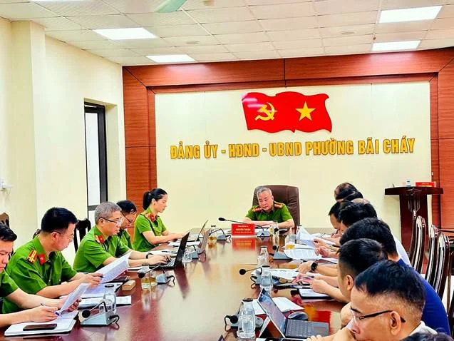
A working session in Bai Chay Ward attended by leaders of the Quang Ninh City Police to review the progress of implementing Plan 2959.
Grassroots working sessions are held regularly and directly between the implementation team and commune- and ward-level leaders, cadastral officials, and police forces. Through this, difficulties regarding original records, information discrepancies, unupdated changes, and more are identified early and resolved on the spot, preventing prolonged backlogs.
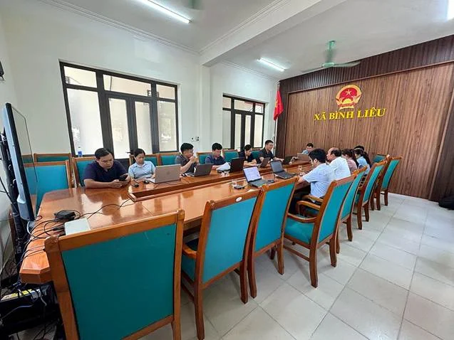
The VNPT-IT team working at the headquarters of Binh Lieu Commune, Quang Ninh City.
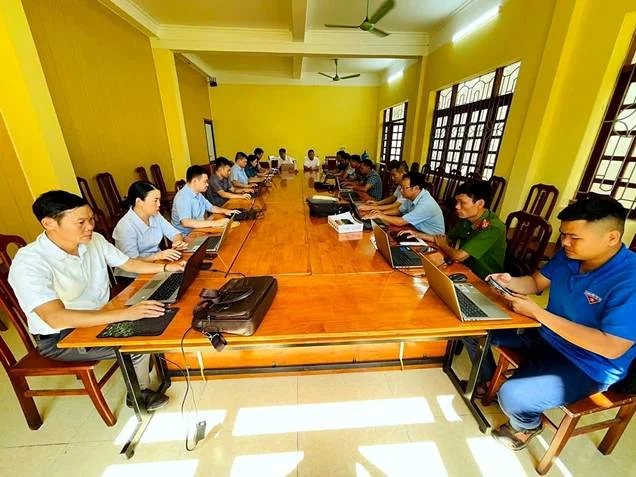
The implementation team coordinates with commune officials, police forces, and youth union members to review and cross-check information at the grassroots level.
Full mobilization of human resources: from conference halls to each record box
To meet the massive workload in a short period of time, VNPT-IT mobilized a team of experts, engineers, and technical staff to reinforce Quang Ninh, combined with the on-site forces of VNPT Quang Ninh. Prior to commencing implementation, all forces underwent centralized training on processes, technical standards, land registration procedures, and the software tools used throughout the data construction process.

The training session on deploying the land database construction in Quang Ninh City organized by VNPT-IT.
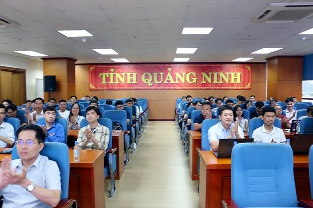
The deployment workforce of VNPT-IT and VNPT Quang Ninh attended the training program.
Beyond the initial training, guidance and technical exchange sessions were maintained throughout the implementation process to standardize the handling of specific cases, ensuring consistent product quality across teams and localities.

The representative of VNPT-IT emphasized the requirements for progress and quality at the implementation conference.
At record collection points, thousands of cadastral record boxes were received, categorized, organized, scanned, and digitized according to strict procedures. The implementation team worked urgently and continuously to ensure on-schedule phased handovers.

A large volume of cadastral records was gathered at local facilities to support database development.

Technical staff classify and cross-check cadastral records to support database development.

The line for scanning and digitizing cadastral records is organized centrally and continuously.
In parallel with digitization, cadastral records are organized and managed scientifically in archives, ensuring easy lookup and cross-checking throughout the data development process and for subsequent utilization.
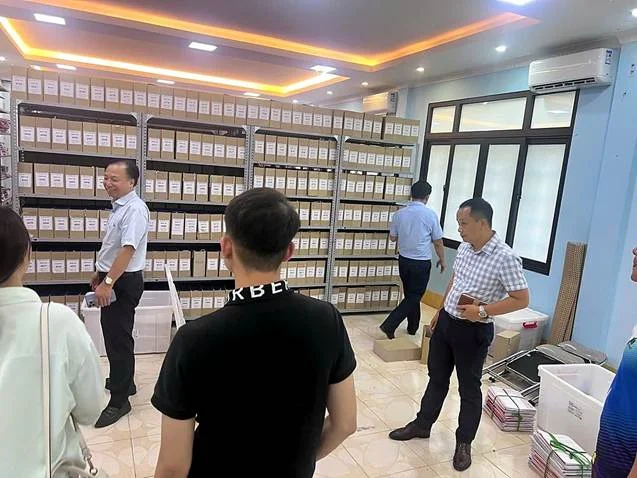
Inspecting the receipt and management of records at the archive.
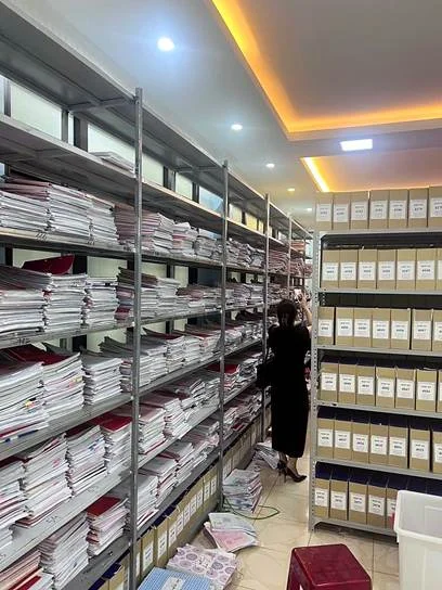
Cadastral records are scientifically organized on storage shelving systems.
Technology as the foundation, quality as the measure
With years of experience developing and deploying the Land Information System VNPT iLIS across numerous provinces and cities, VNPT-IT systematically applies a suite of tools for building, standardizing, and updating cadastral data on a unified platform, ensuring that once finalized, the data can be operated, updated with changes, and connected and synchronized to the national land database.
In particular, VNPT-IT has developed dedicated construction management support tools for Quang Ninh: an online progress tracking tool broken down by commune and handover phase, enabling stakeholders to capture real-time updates; and a self-inspection quality toolkit that simulates supervisory consultancy criteria, helping detect and resolve defects right from the implementation phase to minimize product rejections.
Using technology as the foundation and product quality as the yardstick helps the data development process in Quang Ninh both ensure timely progress and aim for the goal of "accurate - sufficient - clean - alive" data, ready to serve administrative procedures for citizens and businesses.
Scaling up the model, determined to reach the finish line by the end of 2026
From the experience in Quang Ninh, VNPT-IT is scaling up this approach in implementing Plan 2959 across numerous other provinces and cities, such as Lam Dong, Thanh Hoa, An Giang, Dong Thap, Lai Chau, Gia Lai, Dien Bien, Da Nang, etc., while participating in two key groups of tasks: providing technology solutions and infrastructure for managing, operating, and exploiting land databases; and directly reviewing, cleaning, standardizing, supplementing, and building data according to the scope of tasks assigned in each locality.
As the deadline for completing Plan 2959 approaches, VNPT-IT continues to prioritize resources, strengthen coordination with localities, focus on resolving technical issues, and ensure the progress of tasks within its scope of participation.
With the determination of "Right Thinking - Swift Action", VNPT-IT is committed to accompanying Quang Ninh City and localities to reach the finish line of Plan 2959, contributing to building a modern, synchronized, and unified national land database that effectively serves state management, socio-economic development, and national digital transformation.